Estaciones Permanentes GNSS
La Comunidad de Madrid dispone de una red de estaciones base de referencia GNSS (Global Navigation Satellite System), que ofrecen posicionamiento terrestre de alta precisión.
Red Geodésica GNSS de la Comunidad de Madrid
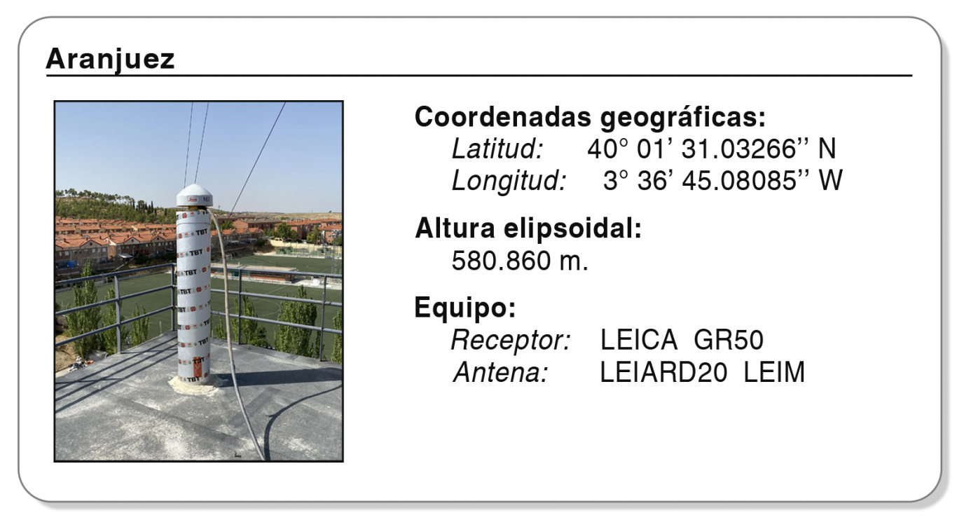
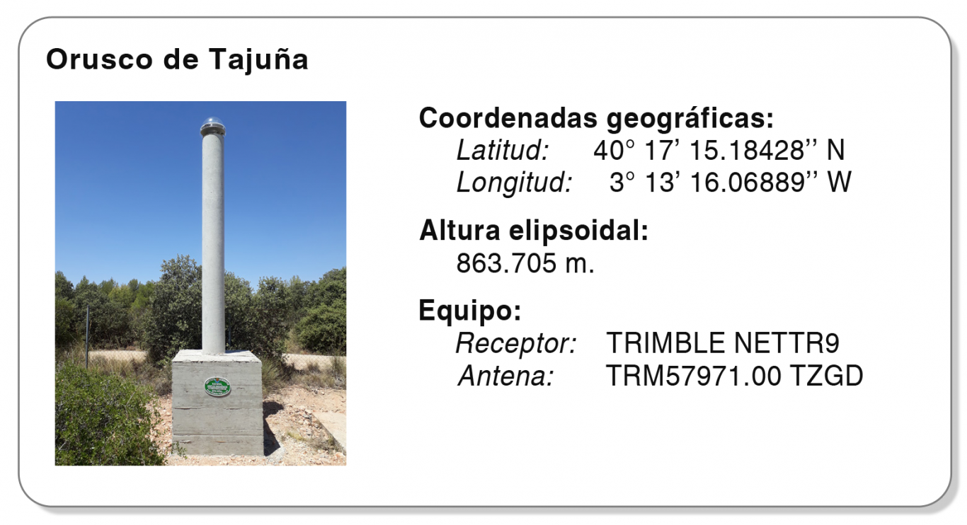
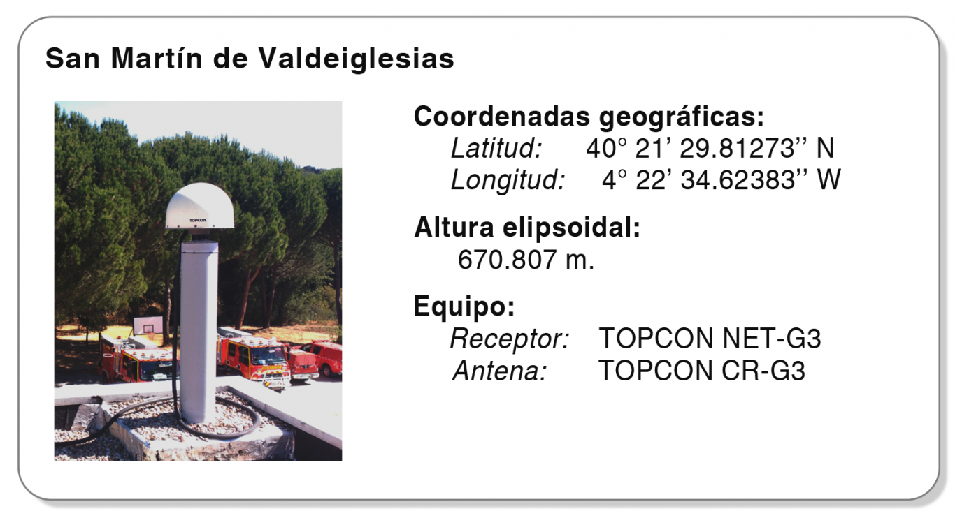
La red de la Comunidad de Madrid se compone de cinco estaciones: Orusco de Tajuña, San Martín de Valdeiglesias, Escuela Técnica Superior de Ingeniería Civil, Puerto de Navacerrada y Aranjuez. Todas ellas están integradas en la Red Geodésica Nacional de Estaciones de Referencia GNSS (ERGNSS), y proporcionan gratuitamente correcciones diferenciales en tiempo real, así como para posproceso. Estas correcciones se pueden obtener a través de los siguientes enlaces:
Servicio de Posicionamiento diferencial GNSS en Tiempo Real
Descarga de ficheros RINEX, para el posproceso
La red ERGNSS consta de estaciones distribuidas uniformemente por todo el territorio nacional, destinadas a la realización de estudios geodésicos y geodinámicos, sirviendo además de soporte para otros trabajos técnicos y científicos de topografía y cartografía, y para dar servicio de posicionamiento preciso en tiempo real en ámbitos de la agricultura, obra civil y navegación. Los usuarios del sistema de estaciones pueden obtener su posicionamiento con precisión centimétrica. El servicio GNSS es multiconstelación, ya que emplea los datos emitidos por los satélites de varias constelaciones: GPS, GLONASS y GALILEO, etc.

Estaciones Permanentes GNSS
Enlaces a las reseñas de cada estación, con información adicional (situación, coordenadas, instrumentación, etc.)